


Precinct 4-1, Richmond County, Virginia
About
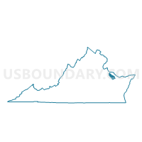
Outline

Summary
| Unique Area Identifier | 682413 |
| Name | Precinct 4-1 |
| County | Richmond County |
| State | Virginia |
| Area (square miles) | 48.95 |
| Land Area (square miles) | 44.01 |
| Water Area (square miles) | 4.94 |
| % of Land Area | 89.90 |
| % of Water Area | 10.10 |
| Latitude of the Internal Point | 37.87303260 |
| Longtitude of the Internal Point | -76.60506930 |
Maps


Graphs
Select a template below for downloading or customizing gragh for Precinct 4-1, Richmond County, Virginia


Neighbors
Neighoring Voting District (by Name) Neighboring Voting District on the Map
- Voting District 1a, Northumberland County, VA
- Voting District 2a, Northumberland County, VA
- Precinct 1-1, Lancaster County, VA
- Precinct 1-1, Richmond County, VA
- Precinct 2-1, Richmond County, VA
- Precinct 2-1, Lancaster County, VA
- Precinct 3-2, Richmond County, VA
- South Voting District, Essex County, VA
- Waterview Voting District, Middlesex County, VA
Top 10 Neighboring County Subdivision (by Population) Neighboring County Subdivision on the Map
- District 2, Richmond County, VA (2,904)
- District 1, Northumberland County, VA (2,629)
- South district, Essex County, VA (2,481)
- District 2, Northumberland County, VA (2,449)
- District 1, Lancaster County, VA (2,413)
- Jamaica district, Middlesex County, VA (2,237)
- District 2, Lancaster County, VA (2,076)
- District 4, Richmond County, VA (1,566)
- District 3, Richmond County, VA (1,487)
- District 1, Richmond County, VA (1,368)
Top 10 Neighboring Unified School District (by Population) Neighboring Unified School District on the Map
- Northumberland County Public Schools, VA (12,330)
- Lancaster County Public Schools, VA (11,391)
- Essex County Public Schools, VA (11,151)
- Middlesex County Public Schools, VA (10,959)
- Richmond County Public Schools, VA (9,254)
Top 10 Neighboring State Legislative District Lower Chamber (by Population) Neighboring State Legislative District Lower Chamber on the Map
Top 10 Neighboring State Legislative District Upper Chamber (by Population) Neighboring State Legislative District Upper Chamber on the Map
Top 10 Neighboring 111th Congressional District (by Population) Neighboring 111th Congressional District on the Map
Top 10 Neighboring Census Tract (by Population) Neighboring Census Tract on the Map
- Census Tract 401, Richmond County, VA (5,416)
- Census Tract 201, Northumberland County, VA (3,903)
- Census Tract 402, Richmond County, VA (3,838)
- Census Tract 301, Lancaster County, VA (3,500)
- Census Tract 202, Northumberland County, VA (3,135)
- Census Tract 9508, Essex County, VA (3,125)
- Census Tract 9509, Middlesex County, VA (1,600)
Top 10 Neighboring 5-Digit ZIP Code Tabulation Area (by Population) Neighboring 5-Digit ZIP Code Tabulation Area on the Map
- 22572, VA (7,470)
- 22473, VA (5,099)
- 22503, VA (4,334)
- 22435, VA (2,439)
- 22460, VA (1,876)
- 23079, VA (437)
- 22504, VA (263)
- 22548, VA (73)